Welcome to EO4 Ecology
We are a nonprofit research organization dedicated to protecting natural habitats through cutting-edge Earth Observation technology.
Our approach is to merge remote-sensed satellite data, field data, and state-of-the-art analytics to monitor natural and agricultural habitats in near real time.
Our Mission
EO4 Ecology combines advanced Earth Observation technologies with conservation science to protect natural and agricultural habitats in Europe, Asia, and Africa. By monitoring habitats from space and with ground-based sensors, we identify threats early and enable timely interventions by rangers, policymakers, and local communities.
Who We Are
EO4 Ecology is a multidisciplinary team of scientists, conservationists, engineers, and data experts. We collaborate with university research labs, governments, NGOs, and local communities to bridge cutting-edge science with on-the-ground action.
Expertise
Forest Health Monitoring
We use high-resolution satellite imagery and advanced analytics to continuously assess forest condition across large spatial scales. By detecting early signs of stress, disease, and degradation, we enable timely interventions that support ecosystem resilience and biodiversity conservation.
Forest Phenology and Climate Change
Track changes in forest phenology—such as earlier leaf-out (greening), shifts in flowering, and altered fruiting cycles—driven by rising temperatures and changing precipitation patterns. These shifts can create mismatches between plants and pollinators, reducing reproduction success, while also increasing vulnerability to pests and diseases that thrive under warmer conditions.
Soil, Water & Drought Monitoring
We integrate satellite-derived indicators with ground data to monitor soil moisture, water availability, and drought dynamics. This allows us to provide early warnings and actionable insights for sustainable land and water resource management.
State-of-the-Art Downscaling of Historical Satellite Data
We develop advanced methods to enhance the spatial and temporal resolution of historical satellite datasets. This enables detailed retrospective analyses, improving our understanding of long-term environmental changes and trends.
Ground Truth Point Dataset Creation
Accurate field data is essential for validating and improving remote sensing models. We design and collect high-quality ground truth datasets that strengthen model reliability and ensure robust environmental monitoring outcomes.
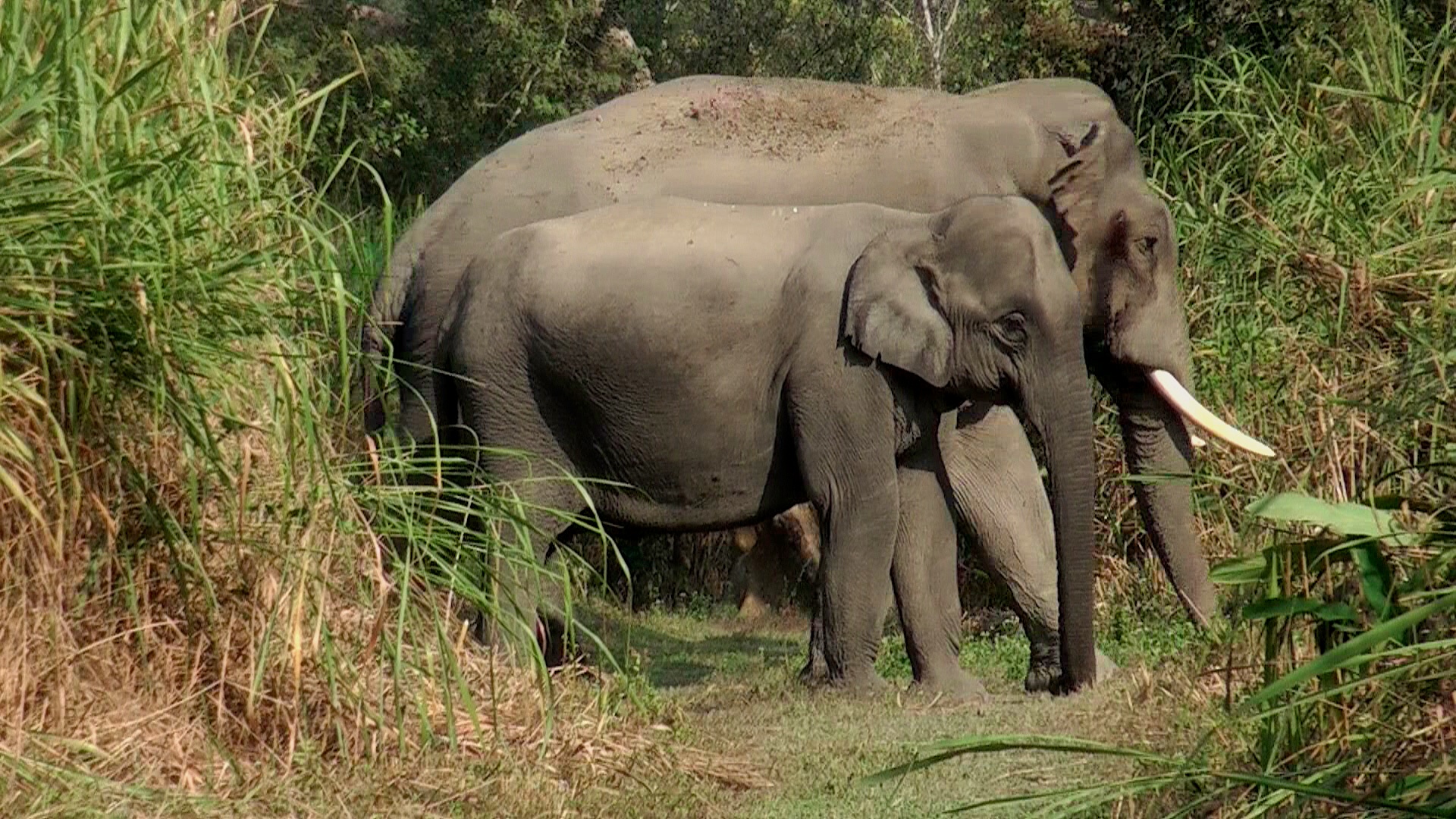
Wild Elephant Habitat Monitoring in Asia
We combine Earth Observation data with ecological modelling to map and monitor elephant habitats. Our approach helps identify movement patterns and conflict zones, supporting conservation efforts and reducing human-elephant interactions.
Our Team
Co-Founders

Dr. Karpagam Chelliah
Co-Founder
Ecology, Evolutionary Biology, Mathematical Modelling, Machine Learning and Scientific Software Engineering

Dr. Fabio Francesconi
Co-Founder
Earth Observation, Geospatial Analysis, Botany, Habitat Suitability and Climate Change Science.

Dr.Roberto Valenti
Co-Founder
Botany, Geology, Soil Science and and Ecosystem Dynamics.
Advisory Committee

Prof. Fabio Attore
Advisor

Dr. Mahua Ghara
Advisor